Routes at High Camp
Lost Sierra • Portola, CA
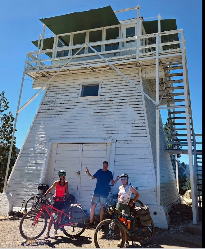

Beckwourth Peak High Camp is a great destination for an overnight bikepacking trip. In fact, a bikepacking trip along the San Juan Hut System sparked the idea for creating High Camp in the Lost Sierra.
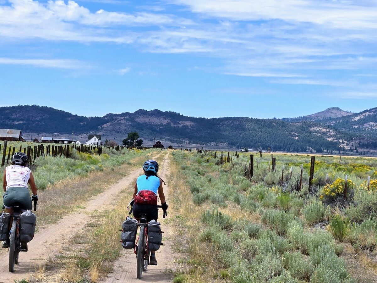
We've done extensive scouting and refining of these routes. They consist of forest roads, quiet highways, and some singletrack (not technical). We recommend a gravel bike with 45mm wide tires or a hardtail mountain bike. Depending on your bike's range, an ebike could be an option too.
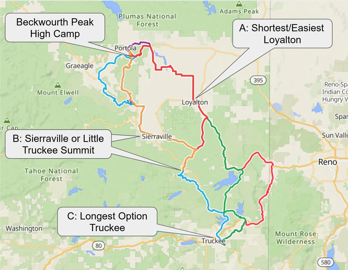
All routes are available in the Ride with GPS collection.
The most accessible option. Mostly paved through the open ranchlands of Sierra Valley, with the town of Loyalton as your starting point.
Loyalton to High Camp
High Camp to Loyalton
Starting from Sierraville in the southern Sierra Valley. Mixed surfaces through the valley and into the Lost Sierra, with an alternate return option.
Sierraville to High Camp
High Camp to Sierraville
High Camp to Sierraville (Alt)
From the Tahoe National Forest over Little Truckee Summit and down into the Lost Sierra. The return is mostly unpaved with significant climbing.
Little Truckee Summit to High Camp
High Camp to Little Truckee Summit
The full adventure, starting from Truckee. An alternate via the Tahoe Pacific Trail and Verdi adds distance and singletrack for those who want more.
Truckee to High Camp
Truckee to High Camp (via TPT & Verdi)
High Camp to Truckee
Routes
View on Ride with GPSRecommended Bike